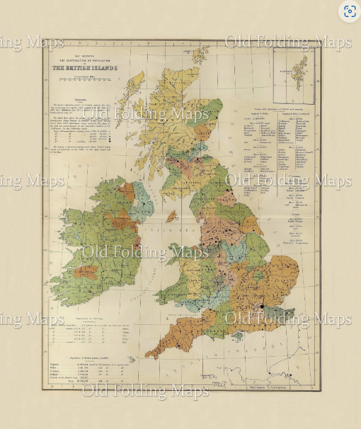
This colourful map shows the population of the British Isles according to the 1861 census. The counties are marked out in different colours, with extra detail about populations included in the key.
A beautiful addition to any wall, as well as a fascinating talking point, vintage maps such as this can be endlessly fascinating to study.
Dimensions: 400 x 500mm
Laid on 100% cotton and presented in a marbled slip case. (Designs and colours of slip cases vary).