


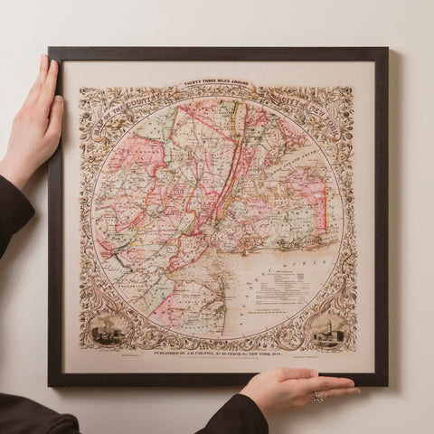


This republished copy of an antique map shows the country 33 miles around the city of New York. It was first published circa 1849 by Joseph Hutchins Colton, an American map maker, who was active between 1833 and 1897.
The beautiful hand coloured map illustrates the counties of Ocean, New Jersey, Suffolk, Rockland, Somerset, Hudson, Richmond and Queens. Statelines, county lines, townships, railroads and canals are all depicted, with the addition of an intricate decorative border.
Dimensions: 560 x 560mm
Laid on 100% cotton and presented in a marbled slip case. (Designs and colours of slip cases vary).